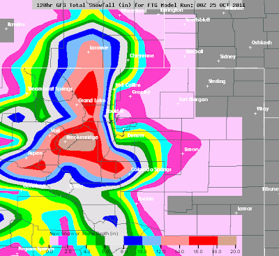
The above image shows the GFS model forecast for total accumulated snow through 7am CDT on Thursday, 10-27-11. As you can see, 12 inch plus amounts are forecast in the central and northern Rockies, from just West of Denver through west of Cheyenne.
The image below is based on output from the same computer model, but centered in on the Denver area:
The yellow and green shaded areas on the Southern and Western sides of Denver show where 4-6 inches of snow is forecast by the model at this time. Even heavier amounts are forecast in the foothills of Colorado Springs and to the West of Pueblo.
I'll have a more detailed post later today including my thoughts on the latest model data, etc., but folks in Colorado and Wyoming can expect a taste of winter over the next couple of days for sure...
If you enjoy reading 'The Original Weather Blog', please be sure to "like" our facebook page!


No comments:
Post a Comment