In a post last Sunday I outlined what (at the time) the latest computer forecast model solutions were indicating for the Yucatan region this weekend. This included what the computers were suggesting would be a rather strong tropical system developing off of the Yucatan Peninsula by Sunday (tomorrow) evening.
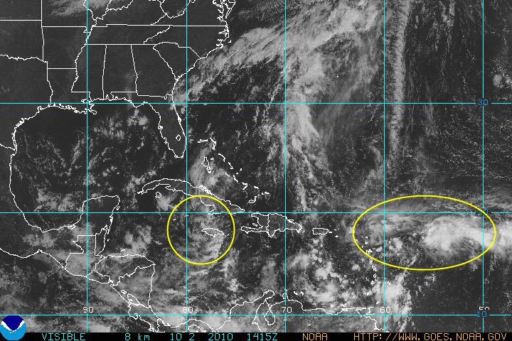
Well, as you can see by the satellite image (taken a few moments ago) above, there is indeed a tropical disturbance approaching the Yucatan region (yellow encircled area in the lower left quadrant of the image), but so far it is not nearly as strong as was indicated by the models last weekend. Conditions aren't currently very favorable for strong organization or intensification of this system, however it will need to be monitored over the next 24-36 hours.
At this point in time, that's about all the computer models are good for as far as "medium range" forecasting in the tropics is concerned. They do a pretty good job at letting you know of general areas to watch at a given point in time, but don't always have success at pinning-down the details.
Another, stronger, area of disturbed weather is located near and East of the Leeward Islands in the Eastern Atlantic (the 2nd yellow encircled area on the lower right side of the image). This system has a slightly greater chance of further development as it moves Westward over the next 24-48 hours.
No comments:
Post a Comment